Accurate maps are critical for traveling from point A to B. The same is true in our world of environmental consulting and management. With our experience in advanced GPS recording, drones, and CAD/GIS technologies we here to guide your project from start to finish.
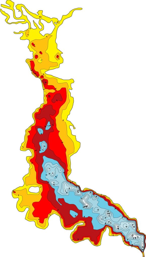
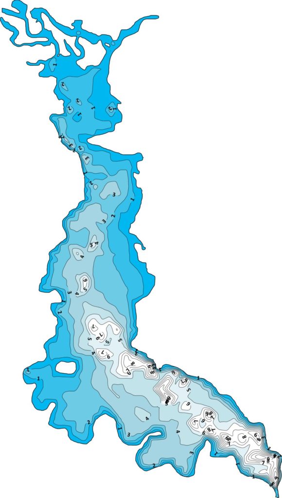
Water / Sediment Depths
Getting into the depths of our mapping WLPR provides custom water and sediment depth mapping. Fishermen regularly rely on detailed hotspots maps to catch their quarry. Large or small, we’ll create a depth contour map for your own fishing paradise. Worried that your stormwater basin is aging and filling in? Our in-house experts will accurately map sediment accumulation in your pond. Contact us today to help turn back the hands of time.
Environmental (species, etc.)
Clean up on Aisle 3.
But, where’s Aisle 3 and what’s in it? Our custom mapping abilities can assist your environmental project in many ways. Whether it’s a plan to putting the finishing touches on your pond, complete species inventory on your waterbody, or identifying areas of invasive species (link to AIS on professional services) to clean up we have you covered.
Permitting
Ponds, vegetation control, land disturbance, and many more activities may all require permit approval before beginning. From State to local municipalities we are able to assist you to obtain your permits and begin your project. Our expertise in mapping, wetland delineation, stormwater, and invasive species identification and control will ensure your project goes off without a hitch.